14
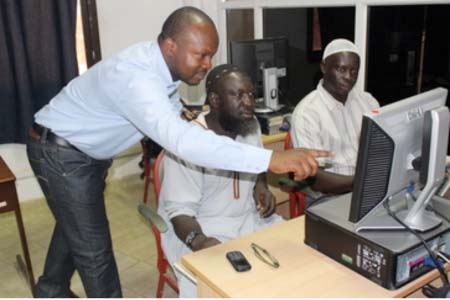
April 2017, Banjul, Gambia – The Department of Forestry and the Food and
Agriculture Organization of the United Nations (FAO) conducted a training for
10 government personnel on the use of an innovative tool to effectively and
efficiently assess and monitor the country`s land cover and land use. The
five-day training in Banjul on biophysical baseline assessment using the
Collect Earth Tool occurred on 10 to 14 April 2017 and was organized under the
auspices of the project ‘‘Action Against Desertification’’ (AAD) project funded
by the EU and ACP Secretariat. The capacity development exercise will enable
the Country Team to produce a baseline report that will highlight the status of
drylands in the country and help to identify spots which require restoration.
The
baseline will also serve as a basis for evidence-based decision making and for
monitoring the impact of efforts to restore degraded lands and to improve
ecosystems and communities resilience in drylands. Participants of the workshop
were drawn from various institutions, including the Planning Service Unit, the
Department of Forestry, the Department of Land and surveys, the Gambia Bureau
of Statistics, the Department of Parks and Wildlife Management and the National
Environment Agency.
The
intervention is congruent with FAO`s Mandate and Country Programming Framework
(2016-2017) and other national, regional and international development
blueprints. In The Gambia, the underlying driver for degradation of dryland
forests is the increasing population pressure and the resulting direct causes
are; i) unsustainable and uncontrolled resource extraction and ii) Forest
fires, caused by underlying drivers like increasing population pressure and
lack of adequate socioeconomic/livelihood opportunities(National Forestry
Assessment 2010).
Patrick
Bahal’okwibale, FAO’s Associate Professional Officer for climate change
adaptation and mitigation in drylands and lead facilitator of the workshop,
explained that the lack of quantitative information on status and trends of
environmental and land degradation remains a huge obstacle in catalyzing
appropriate interventions and practices to combat desertification and restore
degraded lands in The Gambia’s drylands.
Mr. Bahal’okwibale noted that the training will strengthen ongoing
efforts to effectively address the menace of degradation of dryland forests in
The Gambia.
He
said: “The Collect Earth tool enables the trainees to assess and monitor the
land cover and land use through the visualization of very high resolution
images. The least that can be said is that it enables the user to even count
the number of trees in a given area. The training will thus enable the country
team to produce a baseline report that will highlight the status of drylands in
the country. The baseline will also serve as a basis for monitoring the impact
of efforts to restore degraded lands and to improve ecosystems and communities’
resilience in drylands’’.
Malang
Jatta, National Focal Point for the Great Green Wall for the Sahel and Sahara
Initiative (GGWSSI) lamented that deforestation and land degradation are major
environmental issues faced by The Gambia. Nearly 70% of the country`s forest
cover of 423,000 hectares (about 37% of the total land area) is degraded
(National Forestry Assessment 2010).
Background
The
Great Green Wall for the Sahel and Sahara Initiative (GGWSSI) is a Pan African
programme being implemented over 20 countries in the Sahara and Sahel region.
The overall goal of the GGWSSI is to improve the resilience of human and
natural systems in the Sahel-Saharan zone against climate changes through a
sound and sustainable development of land resources, the protection of rural
heritage and the improvement of the livelihoods of the populations living in
these areas.
With
FAO Technical support and EU financial support in 2012, The Gambia adopted a
national action plan for the implementation of the GGWSSI. The project “Action
against desertification” is supporting the implementation of this Action Plan,
particularly in the northern regions of the River Gambia that is North Bank,
Central River Region North and Upper River Region North covering 589,000
hectares. A key aim of the project is to enhance conditions and the enabling
environment (laws, regulations, incentives, etc.) needed to enable rural
communities to sustainably manage and use their natural resources. The project
will directly assist some 390,283 (203,950 females and 186,329 males) who are
highly dependent on natural resources for their livelihood.
The
AAD project is being implemented by the Department of Forestry under the
Ministry of Environment, Climate Change and Natural Resources with other
Implementing Partners like the Ministry of Basic and Secondary Education
(MoBSE), the Natural Resources Consulting (NACO) and the Association for the
Development of Women and Children (ADWAC) in close collaboration with FAO, responsible
for project execution and the provision of technical support.
Source:
FAO Gambia


