
The training was funded and implemented by Climate Change Office at the University of the Gambia through the MRV Pilot Project.
The Monitoring Reporting Verification MRV Pilot Programme project is focused on establishing a robust Monitoring, Reporting, and Verification (MRV) system for climate actions, particularly those related to greenhouse gas (GHG) emissions reduction and sustainable energy solutions.
Supported by Environmental and Climate Change Canada, the initiative aims to strengthen the country's capacity to track, finance, and implement climate change mitigation strategies.
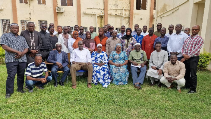
Moreover, the objective of the GIS Mapping training is to build the capacity of the Forestry and other environmental stakeholders in the use and application of Geographical Information Systems and Remote Sensing technologies to monitor the status of the country's natural resource sector.
At the event, Almami Dampha, Project Coordinator MRV Gambia reminded that deforestation and Forest Degradation are the most threatening challenges for the continuous well-being of the forest cover.
The drivers of these phenomena, he revealed are bushfires, illegal forest exploitation for timber, fuelwood extraction, charcoal burning, unsustainable agricultural practices, overgrazing and climate change.
“It is therefore important that sectors like the Forestry Department are capacitated to be able to regularly monitor deforestation and forest degradation.”
That, she said, would also help take appropriate remedial measures to put them under control, pointing out that monitoring forest degradation and deforestation offers numerous benefits to forest managers, including tracking forest loss, identifying forest change drivers, supporting forest conservation efforts, and improving forest management in general.
“So, the idea is actually to create a critical mass of expertise in this area, and that's the whole idea of having this five-day training. It's not just the 10 or 12 people that we've been working for the past 12 months, but we extend it to the larger community of forestry and all those related natural resource environment institutions.”
He expressed delight that they’ve been able to do that with the generous support of the Canadian Government and also their implementing partner, Novo Sphere.
“We want to thank the Forestry Department as the lead focal point, but in that spirit, we also want to extend our heartfelt thanks to the Minister of Environment, Climate Change, as the policy model body for these pilot projects,” he said.
Babanding Sanyang, head of Communication and Education Unit at the Dept of Forestry, described the training as key for Forestry Experts to have the knowledge and practical insights on GIS mapping, which he said, is crucial for effective forest management as it provides a powerful platform for visualising, analysing, and managing spatial data related to forest resources.
The technology, he added, enables forest managers to make informed decisions about conservation, resource extraction, and other crucial aspects of forest stewardship.
“By integrating various data layers like topography, vegetation types, and wildlife habitats, GIS facilitates a comprehensive understanding of forest ecosystems.”
Malang Jassey, deputy Director Dept of Forestry, while thanking the donors for the move, equally urged participants to put into practice what they learned at the training.